
GAMMa
A web application that allows users to view the extent of their own collection against the data available on GBIF.
- R
- Shiny
- leaflet
- sf
- terra
- GBIF
The problem
Botanic gardens and genebanks hold living collections that are meant to safeguard a species' genetic diversity. But a collection of fifty plants gathered from one valley preserves far less than fifty plants gathered across a species' full range, and until recently there was no accessible way for a curator to tell the difference. The analysis existed — it had been developed over a decade of conservation research — but it lived in R scripts that assumed you were a spatial analyst.
The gap was capacity, not method. Institutions of different sizes needed to apply the same assessment without hiring one.
What GAMMa does
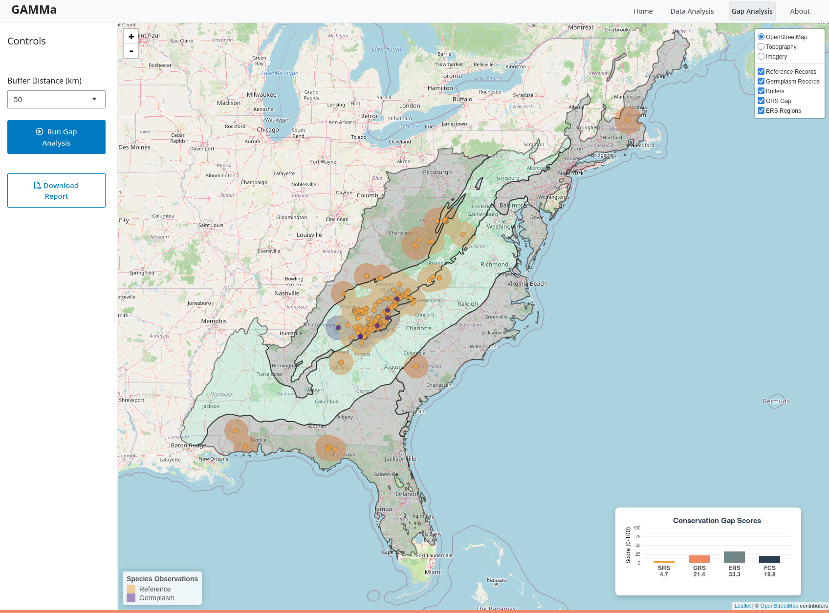
GAMMa compares a collection's accession records against wild occurrence records for the same taxon, then scores how much of the wild range the collection actually covers. Curators pull reference records directly from GBIF inside the tool or upload their own, add their accession data as a spreadsheet, clean the records interactively, and run the analysis.
The result is three scores, each bounded 0–100, averaged into a Final Conservation Score:
- Sampling — germplasm accessions relative to reference records.
- Geographic — the proportion of the estimated wild range falling inside buffers around collection points.
- Ecological — the share of the 814 terrestrial ecoregions the species occupies that the collection reaches.
Low scores localize: the maps show which parts of the range and which ecoregions are missing, which turns an abstract score into a collecting trip. Results export as a shareable HTML report.
The application also works across institutions. Metacollections — the combined holdings of several gardens, managed jointly — can be assessed as a single unit, which is where the redundancy and the real gaps in ex situ conservation tend to show up.
Uploaded data is never stored. Analyses run in a single session and time out, so institutions can assess sensitive collections without handing over records.
How it was built
An R and Shiny application, modularized by analysis stage, with leaflet for the interactive mapping, sf and terra for the spatial work, rgbif for occurrence retrieval against the GBIF Backbone Taxonomy, and R Markdown for report generation. The gap analysis itself extends the methodology of the GapAnalysis R package — the same lineage as the crop wild relatives work — reworked so that a collections manager, not a programmer, is the intended operator.
Outcome
GAMMa is in public beta. The project has run workshops for collections managers since 2024 and produced gap analyses supporting active collecting programs.
The work was initiated in 2023 by the Atlanta Botanical Garden, The Morton Arboretum, and the Montgomery Botanical Center, with a core team drawn from those institutions plus Colorado State University's Geospatial Centroid, the New York Botanical Garden, and BGCI-US. It is supported by the Institute of Museum and Library Services (award MG-252894-OMS-23), BGCI-US, and the United States Botanic Garden.